As Daylight Saving Time Approaches, a Good Opportunity to Look at U.S. Time Zones
Data spotlights represent data and statistics from a specific period of time, and do not reflect ongoing data collection. As individual spotlights are static stories, they are not subject to the Bureau of Transportation Statistics (BTS) web standards and may not be updated after their publication date. Please contact BTS to request updated information.
The clocks in many American households will be set an hour ahead this weekend, signaling the arrival of Daylight Saving Time (DST). This “Spring Forward” tradition is observed across the nation, except for two states (Arizona—exclusive of the Navajo Nation—and Hawaii) and the five major U.S. territories of American Samoa, Guam, the Commonwealth of Northern Mariana Islands, Puerto Rico, and the U.S. Virgin Islands, all of which reside in America’s lesser-known time zones.
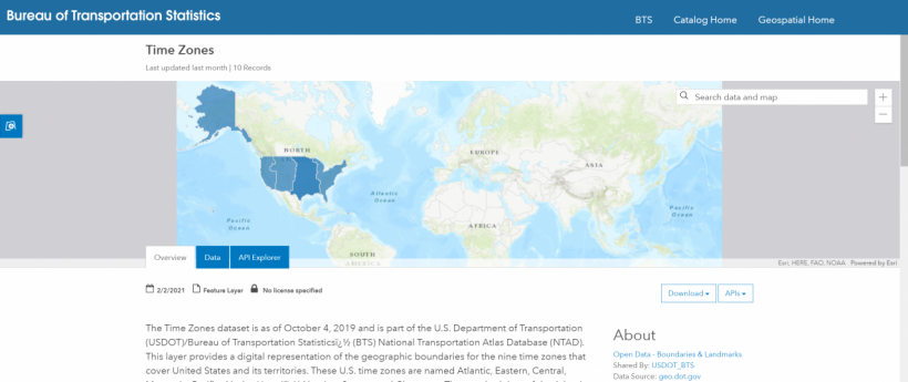
The U.S. Department of Transportation (USDOT) has supervised standard time since the responsibility was transferred by Congress from the Interstate Commerce Commission when USDOT was established in 1966. Within USDOT, the Bureau of Transportation Statistics maintains a dataset of the nation’s time zones (shown below) and their geographical boundaries as part of the National Transportation Atlas Database (NTAD).

How many time zones are in the U.S.?
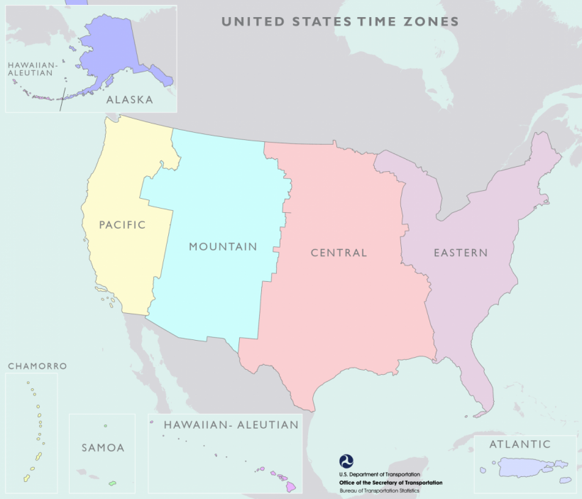
If you live in the continental U.S., also known as “The Lower 48,” you might be forgiven for thinking only of the original Big 4: Eastern, Central, Mountain, and Pacific.
However, as shown below, the U.S. actually has nine time zones. The Atlantic Zone includes Puerto Rico and the U.S. Virgin Islands; the Alaska zone includes all of Alaska except the Aleutian Islands; the Hawaii-Aleutian Zone includes Hawaii and Alaska’s Aleutian Islands; the Samoa zone includes American Samoa; and the Chamorro Zone includes Guam and the Commonwealth of the Northern Mariana Islands.

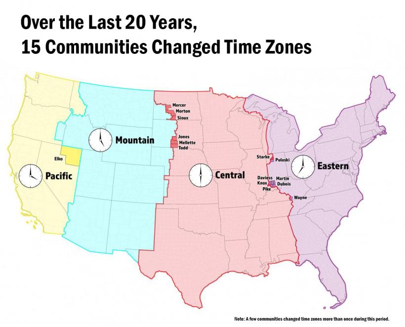
U.S. time zone boundaries have changed as recently as 2010.
Before U.S. and Canadian railroads standardized time zones in 1883, there were more than 144 local times in North America! But, the changes didn’t stop then. In 2006, when eight counties in Indiana changed time zones, BTS contributed the maps used by USDOT to authorize the change.

Learn more about the history of U.S. time zones on our History of U.S. Time Zones and Recent Time Zone Changes pages.
