As Daylight Saving Time Ends, Track US Time Zones in BTS National Transportation Atlas Database
Last weekend, millions of Americans turned back their clocks one hour to mark the return from Daylight Saving Time to Standard Time. But, not everyone did. Some states (Hawaii, Arizona--except for the Navajo Nation within the state) and U.S. territories (American Samoa, Guam, Northern Mariana Islands, Puerto Rico, and the U.S. Virgin Islands) don’t practice the spring and autumn time change.

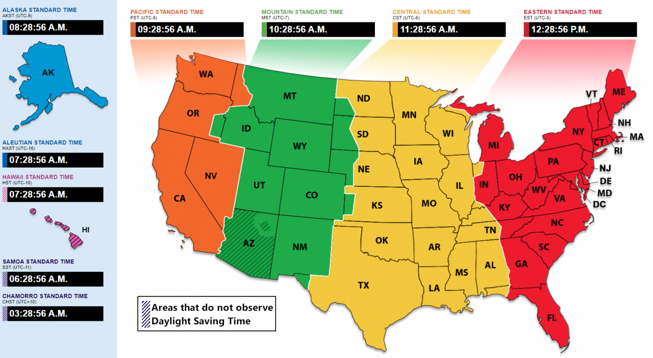
NIST map showing U.S. areas that do not observe DST.
Thank the railroads for our standard time zones
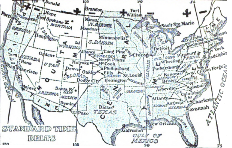
Before time zones were created, each locality set its own clocks to noon at the time of day when the sun was at its highest position. British railroads were the first to adopt standard time in 1840, and railroads in the US and Canada adopted standard time zones in 1883.

Time zone map of the United States from 1913, as published in the Chicago Daily News Almanac and Yearbook.
The early maps had today’s four time zones for the coterminous states, but the boundaries were very different from today. Jurisdictions may apply to the U.S. Department of Transportation to change their time zone.

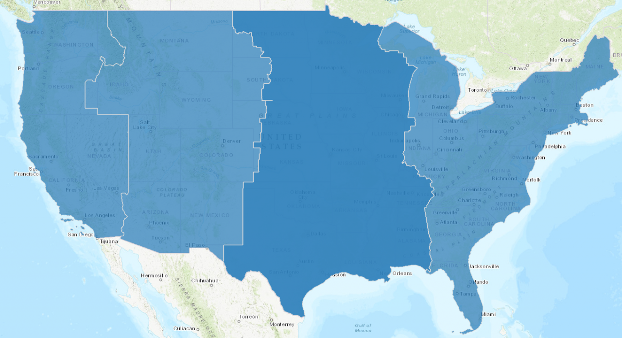
Current U.S. time zones as recorded in the National Transportation Atlas Database
Daylight Saving Time rules begin in 1918 but have changed through the years
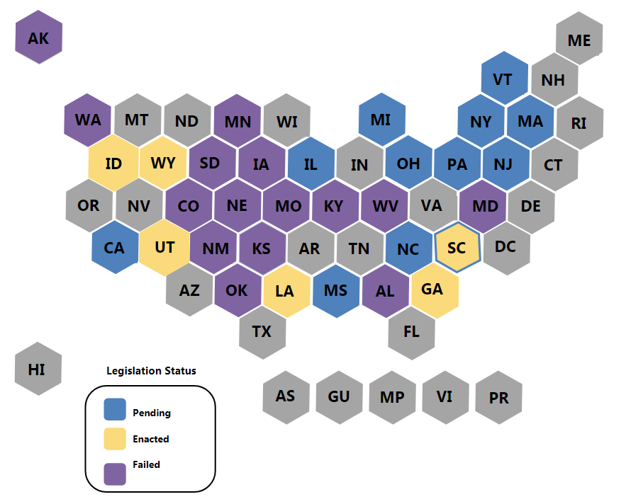
The Standard Time Act of 1918, “an Act to save daylight and to provide standard time for the United States,” authorized the nation’s first “Daylight Saving Time” to begin on the last Sunday of March and conclude on the last Sunday of October. Congress has amended time change laws several times since then. Currently, DST begins the second Sunday in March and ends the first Sunday in November. States can opt-out from DST, but such an exemption must apply to the entire portion of that State that lies in a given time zone (some states, like North Dakota, straddle two different zones). Some States have enacted legislation to adopt DST as their permanent setting, pending federal approval.

National Council of State Legislatures map shows States with legislative activity to adopt year-round DST.
Explore the data
Curious about America’s time zones? The National Transportation Atlas Database provides a digital representation of the geographic boundaries for the nine time zones that cover United States and its territories.
