
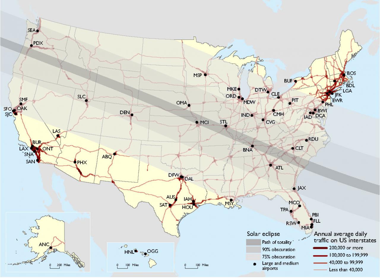
US Interstate Highways and Airports in the Path of the 2017 Solar Eclipse
Eclipse Touches Major Modes of Transportation
The Total Solar Eclipse occurring on August 21 will touch major modes of transportation. Over 2,700 miles out of approximately 48,000 miles of interstate highway and almost 10,000 miles out of approximately 175,000 miles of non-interstate National Highway System (NHS) roads will fall in the path of the total eclipse. As indicated on the map, some of these highways normally experience significant daily traffic volumes and may experience higher volumes on August 21 as people travel to view the eclipse. Two medium size airports lie in the path of a total eclipse (Kansas City, MO, and Nashville, TN), while 4 small airports lie in the path of a total eclipse (Columbia, SC, Charleston, SC, GSP – Greenville-Spartanburg, SC, and Knoxville, TN).
A number of other airports and thousands of NHS miles will experience 90% of the eclipse. More than two-thirds of small airports, over half of medium and large airports, and tens of thousands of NHS miles will experience 75% of the eclipse.
For more information about transportation and the 2017 Total Solar Eclipse please visit the Federal Highway Administration’s Total Solar Eclipse - August 21 Web site.
Notes:
Airports are categorized based on their share of total enplaned passengers: Large–1% or more; Medium–0.25%-0.99%; Small–0.05%-0.24%.
Source:
Airports: U.S. Department of Transportation, Bureau of Transportation Statistics, Air Carrier Airport Activity Statistics and Ontime Performance, 2015; Eclipse: National Aeronautics and Space Administration, Scientific Visualization Studio, 2017 Total Solar Eclipse Map and Shapefiles, 2017; Highways: Highways: U.S. Department of Transportation, Federal Highway Administration, Office of Freight Management and Operations, Freight Analysis Framework, Version 4.2, 2016.