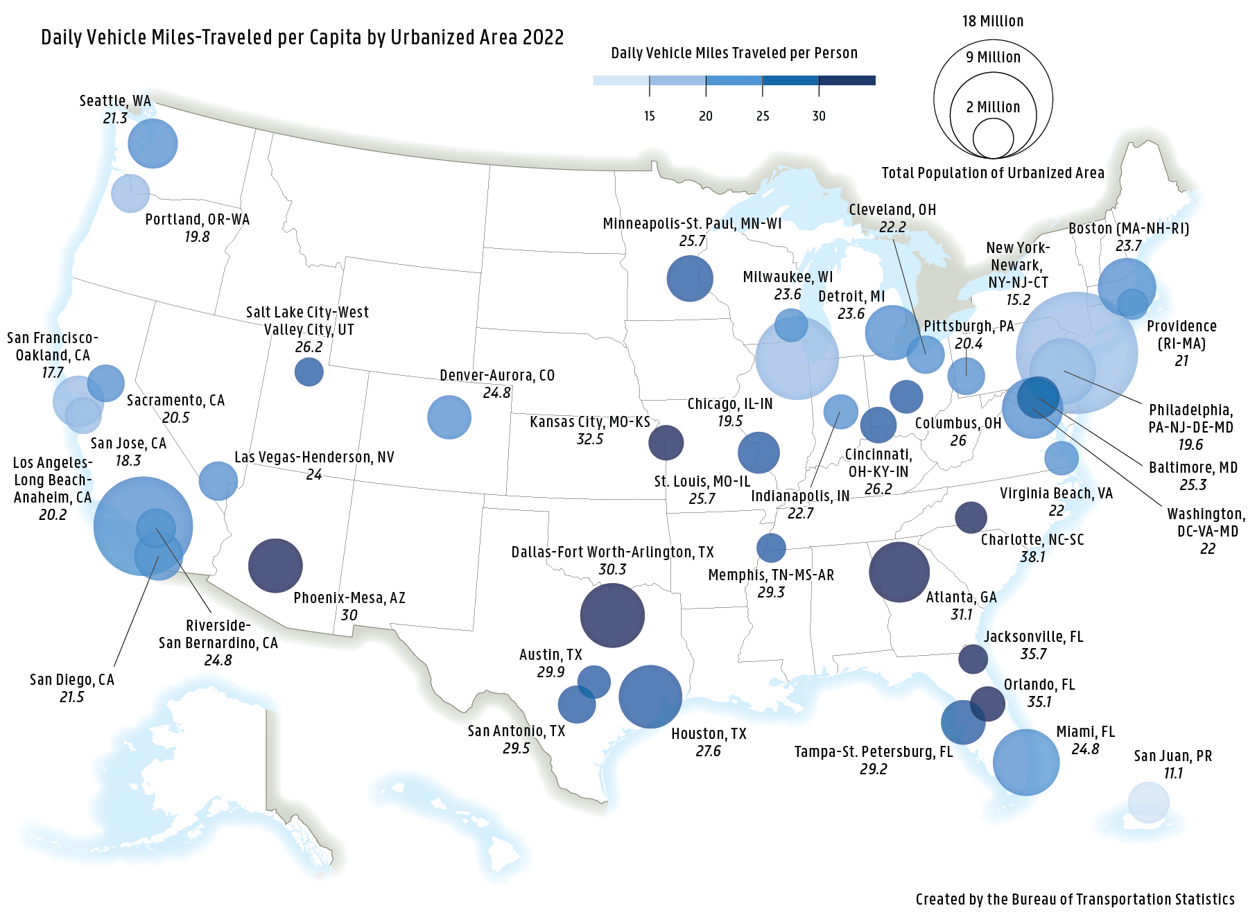
Daily Vehicle Miles-Traveled per Capita by Urbanized Area 2022
Figure

Description:
This map features daily vehicles-miles of travel (VMT) per capita by federal-aid urbanized areas1 with one million or more people. Urban areas with the highest per capita VMT are found predominately in the southeast United States whereas areas with the lowest per capita VMT are found in the Northeast, San Francisco Bay Area, and San Juan, Puerto Rico.
(1) A "Federal-Aid Urbanized Area" is an area with 50,000 or more persons that at a minimum encompasses the land area delineated as the urbanized area by the Bureau of the Census. Urbanized areas or by the Bureau of the Census. Urbanized areas or data may be missing or unreported in some States.
Source:
U.S. Department of Transportation, Bureau of Transportation Statistics; Federal Highway Administration, Highway Statistics Series 2022, Table HM-71.
