
BTS Updates Datasets to National Transportation Atlas Database, Summer 2024
The U.S. Department of Transportation’s (USDOT) Bureau of Transportation Statistics (BTS) today released its summer 2024 update to the National Transportation Atlas Database (NTAD), a set of nationwide geographic databases of transportation facilities, networks, and associated infrastructure.
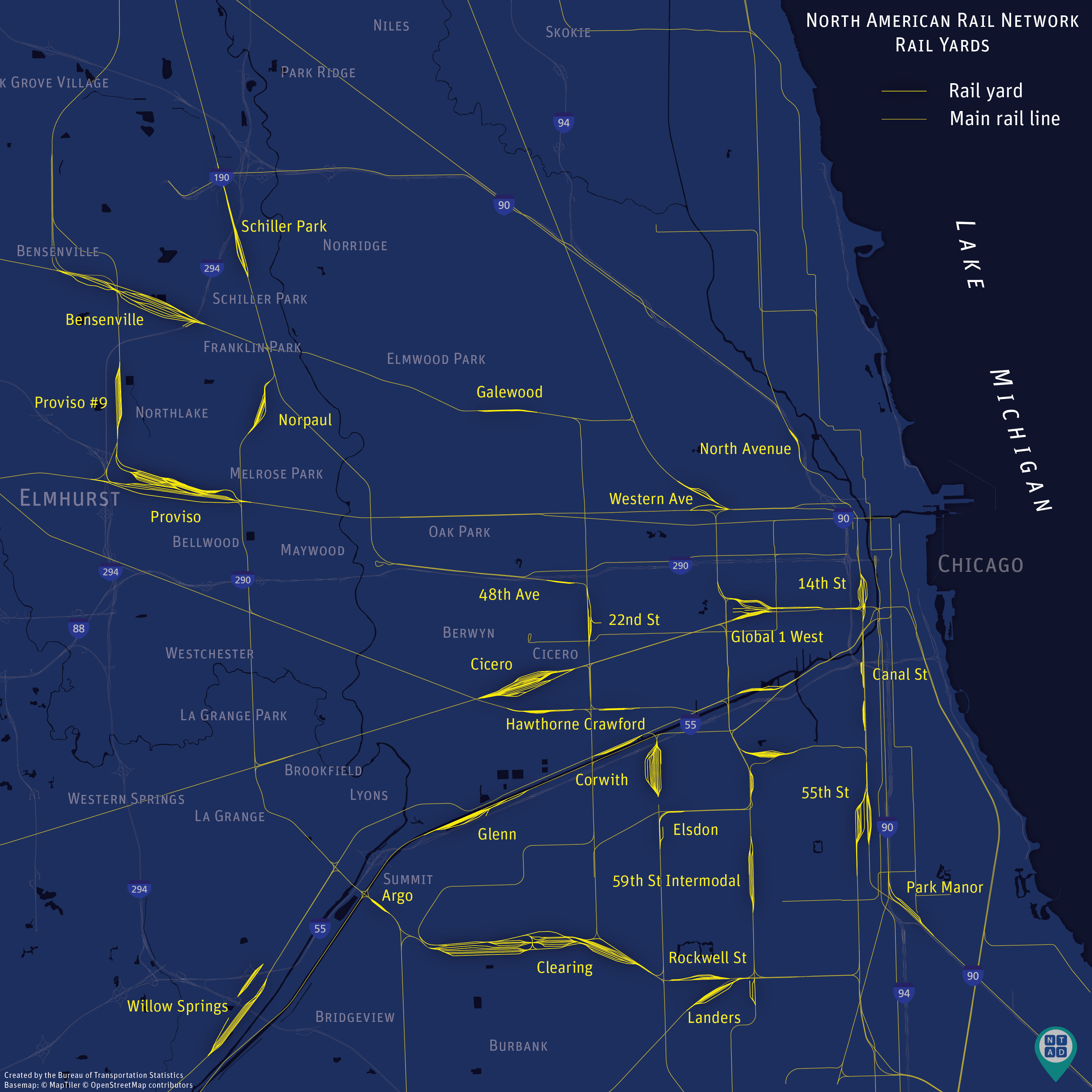
This data release features the addition of a Rail Yards layer which is derived from the North American Rail Network (NARN) line file. This layer was created by aggregating track type and yard designation.
The updated layers in this release include:
- Marine Highways;
- Metropolitan Planning Organization (MPO);
- National Parks;
- 118th Congressional Districts – attributes updated weekly;
- Alternative Fueling Stations – updated daily;
- Inland Electronic Navigational Charts;
- Dams – updated weekly;
- Aviation Facilities – updated monthly;
- Runways – updated monthly;
- Nonattainment Areas;
- 2023 Aggregated Airline Traffic Data by Origin and Destination;
- Intercity Bus Atlas;
- North American Rail Network Lines;
- North American Rail Network Nodes;
- Railroad Grade Crossings;
- National Transit Map Stops;
- National Transit Map Routes;
- National Transit Map Agencies;
- National Highway System;
- STRAHNET view;
- National Bridge Inventory and Element data for 2024;
- National Tunnel Inventory and Element data for 2024;
- 2023 Travel Monitoring Analysis System – Station, Class, and Volume Data;
Below is a map of the locations of rail yards in the greater Chicago area. A rail yard is an area consisting of a network of tracks where trains are assembled, disassembled, interchanged with other railroads, and cars are stored and/or maintained.1 Chicago is the nation’s premier freight hub, with approximately 25 percent of all freight trains and 50 percent of all intermodal trains in the U.S. passing through the area.2 This area serves as the continent’s main interchange point between western and eastern railroads2 as it is the confluence of all 6 class I railroads.
About the National Transportation Atlas Database
NTAD data is available for download in the following formats: File Geodatabase, Shapefile, GeoJSON, comma-separated values (CSV), Keyhole Markup Language (KML), and more through the BTS Geospatial Data Catalog. Additionally, Web Feature Services (WFS) are available for NTAD datasets. Download our public catalog offering and locate the ‘URL’ column to find a dataset’s web service URL. Vector Tile services are available for select NTAD datasets and are best used for cartographic and visualization purposes, and may be found in the NTAD Vector Tile Group.
BTS now uses a dynamic NTAD publication cycle, with updated data released throughout the year as they become available from their respective government agencies. Follow BTS on Twitter, LinkedIn, and Instagram or subscribe to email updates for announcements of additional dataset releases throughout the year.
Contacts
Technical: Dominic Menegus: (202) 306-1587 or ntad@dot.gov.
1 Stanford Research Institute. Railroad Classification Yard Technology: A Survey and Assessment. United States Department of Transportation, Federal Railroad Administration, Office of Research and Development, Washington, D.C., 1977. https://rosap.ntl.bts.gov/view/dot/11919
2Chicago Metropolitan Agency for Planning. Recommendation:
Maintain the region’s status as North America’s freight hub. Chicago, IL.
https://cmap.illinois.gov/regional-plan/goals/recommendation/maintain-the-regions-status-as-north-americas-freight-hub/#:~:text=Strategies&text=By%20almost%20any%20measure%2C%20metropolitan,between%20western%20and%20eastern%20railroads.