
National Transportation Atlas Database Winter 2019 Update
Friday, January 25, 2019 - The Winter 2019 update to the National Transportation Atlas Database (NTAD) was released today with two new datasets, nine revised datasets, 15 vector tile services, and faster web services for all NTAD datasets.
NTAD is a Bureau of Transportation Statistics (BTS) compilation of geospatial datasets representing the nation’s transportation infrastructure, containing roadways, railways, waterways, and airports.
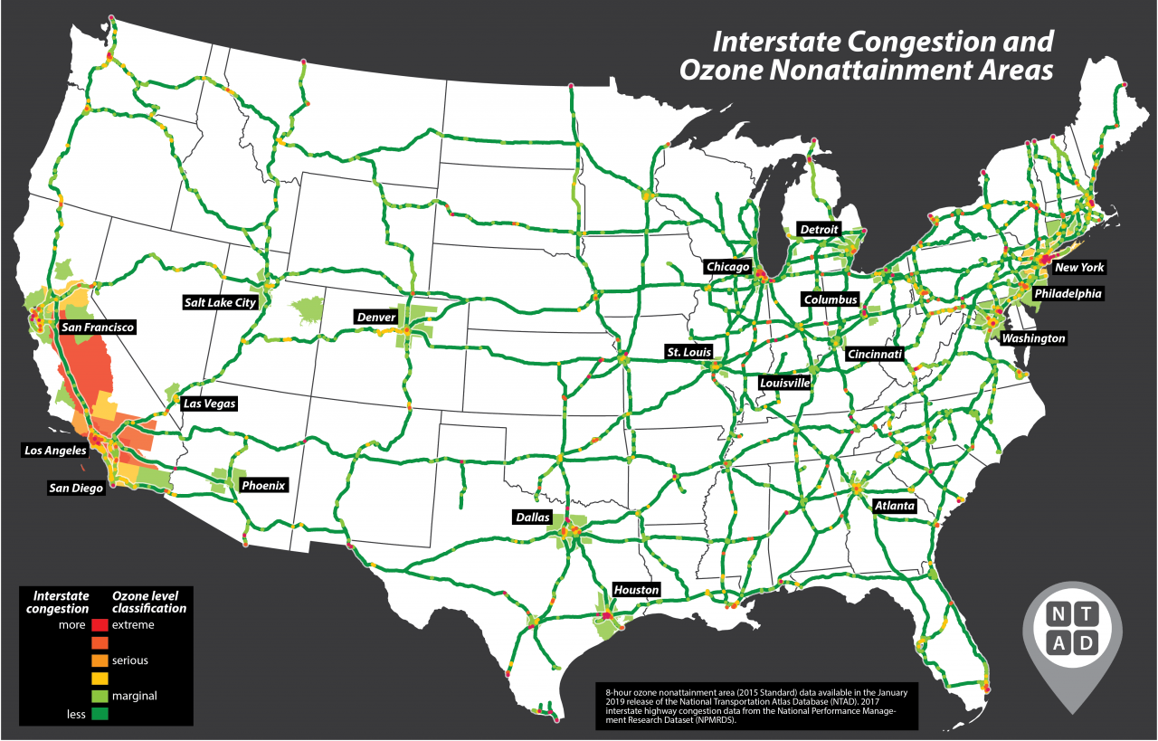
The two new datasets in this version are the Non-Attainment Area 8-Hour Ozone 2015 Standard, and a Trailer On Flat Car (TOFC)/Container On Flat Car (COFC) rail intermodal freight facility layer. The TOFC/COFC facilities is the first in a series of layers to be released as part of the Intermodal Freight Facility database.
Among the updates in this version are:
- The Highway Performance Monitoring System (HPMS) with 2017 values
- Non-Attainment Area Sulfur Dioxide, 2010 Standard
- Rail data including the North American Rail Network (NARN)
- Congressional District data identifying newly elected members of the 116th Congress.
- Metropolitan Planning Organizations
- Alternative Fueling Stations from the Department of Energy
- A geospatially enhanced Marine Highways layer
New and faster web services were also created for all NTAD layers to help efficiently render data in web mapping applications. Also, vector tile services for 15 of the largest NTAD datasets were also created, for cartographic purposes to show large datasets at a national and regional scale. These vector tile services render large amounts of data very quickly but do not provide feature selection capabilities. The new service formats consist of faster full NTAD datasets service names ending in “DS” for each layer, and the vector tiles service names ending in “VT”.
NTAD is available for download in comma separated values (CSV), Keyhole Markup Language (KML), and shapefile formats, through the BTS Geospatial Data Catalog. Additionally, Open Geospatial Consortium (OGC) standard Web Feature Services (WFS) (including Web Mapping Services (WMS)) are available for all NTAD datasets.
BTS now uses a dynamic NTAD publication cycle, making updated data available throughout the year when they become available from their respective government agencies. See @TransportStats on Twitter for announcements of additional dataset releases throughout the year. Contacts: Press: Dave Smallen: (202) 366-5568, david.smallen@dot.gov. For technical information and questions: Dominic Menegus: (202) 366-8717.