
National Transportation Atlas Database Fall 2020 Update
Friday, October 23, 2020 - The Fall 2020 update to the National Transportation Atlas Database (NTAD) was released today with 11 updated datasets.
NTAD is a Bureau of Transportation Statistics (BTS) compilation of geospatial datasets representing the nation’s transportation infrastructure, containing roadways, railways, waterways, and airports.
The updates in this release include:
- Airport data including:
- Airports (Facilities)
- Runways
- Runway Ends;
- Bikeshare;
- Dockless Bikeshare and E-scooters;
- Alternative Fueling Stations;
- Marine Highways;
- National Parks;
- Metropolitan Planning Organization (MPO) boundaries;
- Congressional Districts with names of members updated through Sept. 23; and
- Intermodal Passenger Connectivity Database (IPCD).
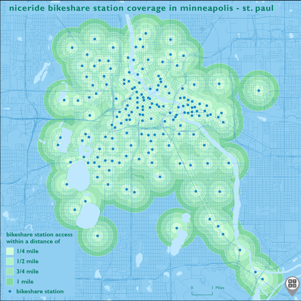
The IPCD includes the bikeshare dataset which showed that in August there were nearly 7,000 bikeshare stations throughout the U.S. More than 170 stations were part of the NiceRide bikeshare system in Minneapolis-St. Paul, Minn. The density of the stations and their balanced spatial distribution are seen on the map below.
NTAD is available for download in comma separated values (CSV), Keyhole Markup Language (KML), and shapefile formats through the BTS Geospatial Data Catalog. Additionally, Open Geospatial Consortium (OGC) standard Web Feature Services (WFS) (including Web Mapping Services (WMS)) are available for all NTAD datasets. Also available are optimized services that allow for fast rendering of full NTAD datasets, and vector tile services for 13 of the largest NTAD datasets. These full NTAD datasets and their respective faster services are designated by service names ending in “DS” for each layer, and the vector tiles service names ending in “VT”.
BTS now uses a dynamic NTAD publication cycle, making updated data available throughout the year when they become available from their respective government agencies. Follow @TransportStats on Twitter for announcements of additional dataset releases throughout the year. Contacts: Press: Dave Smallen: (202) 366-5568. For technical information and questions: Dominic Menegus: (202) 366-8717, or email ntad@dot.gov.