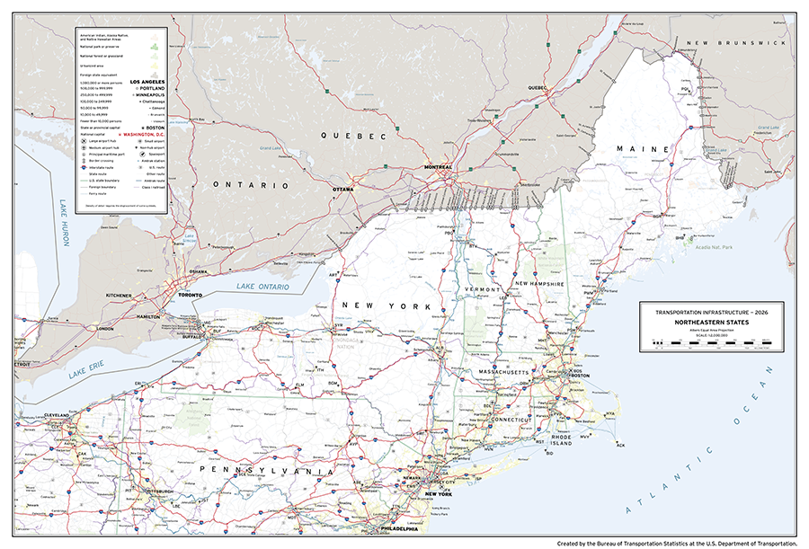
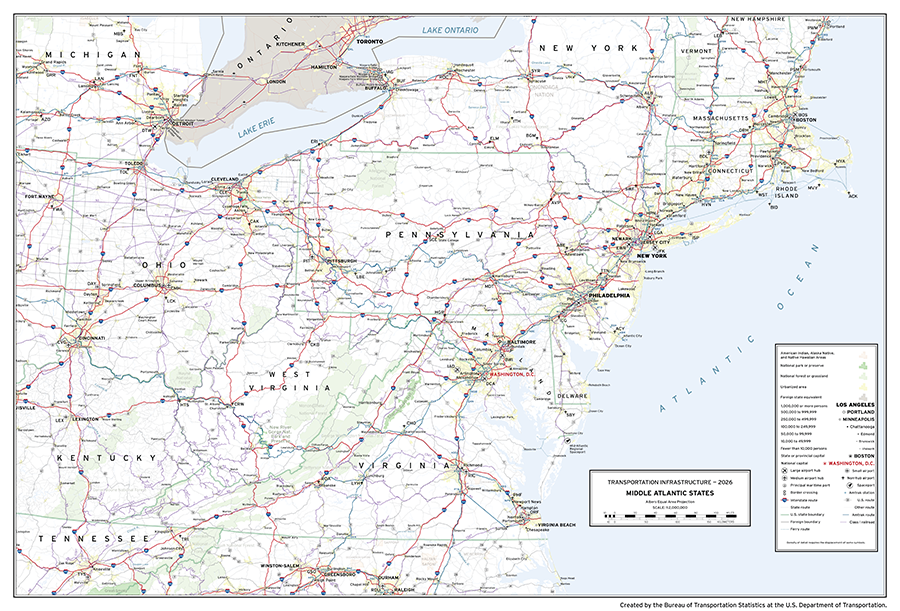
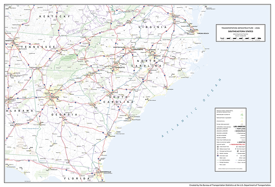
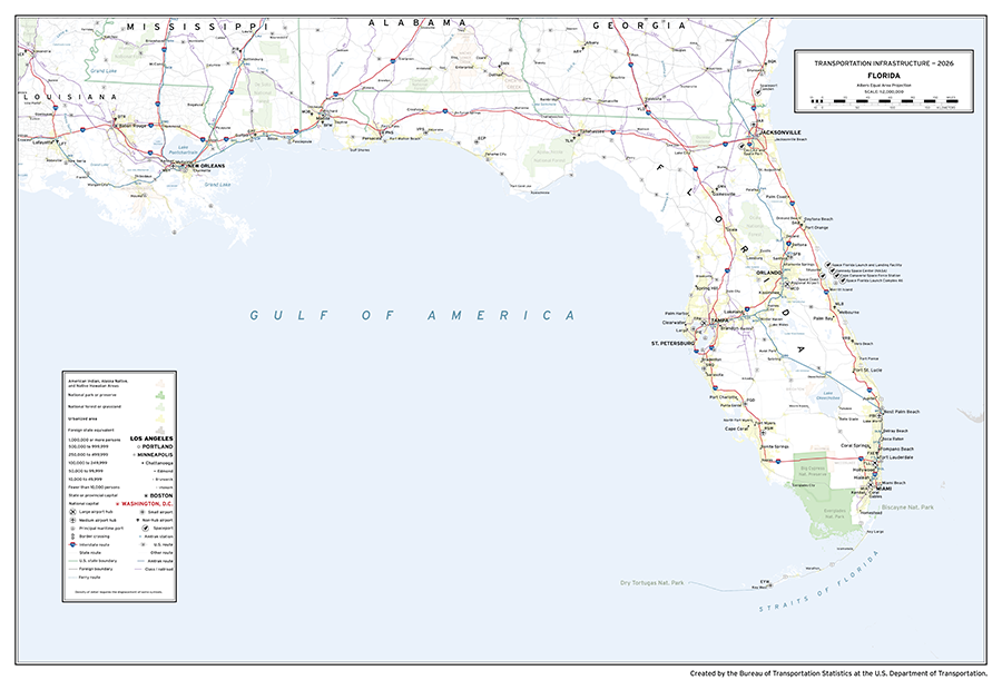
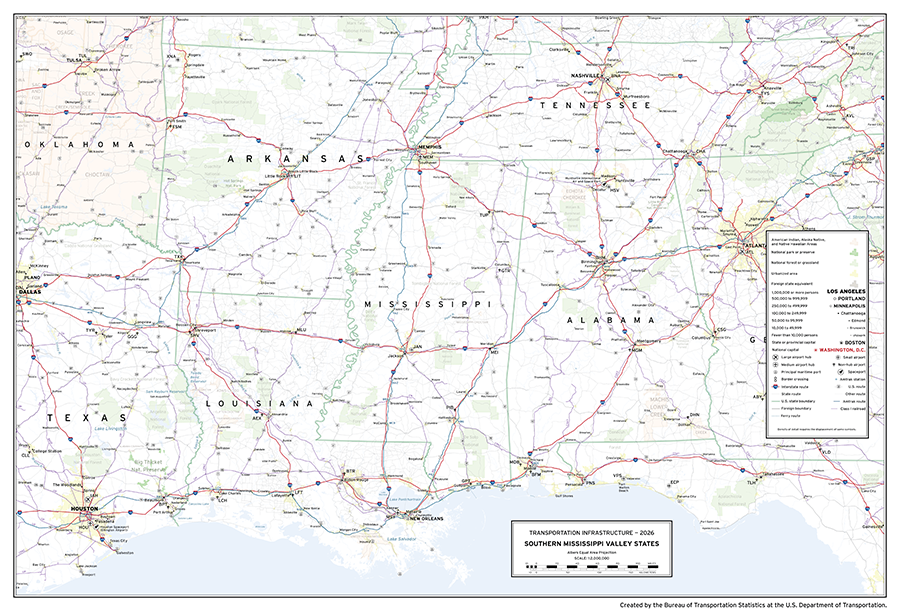
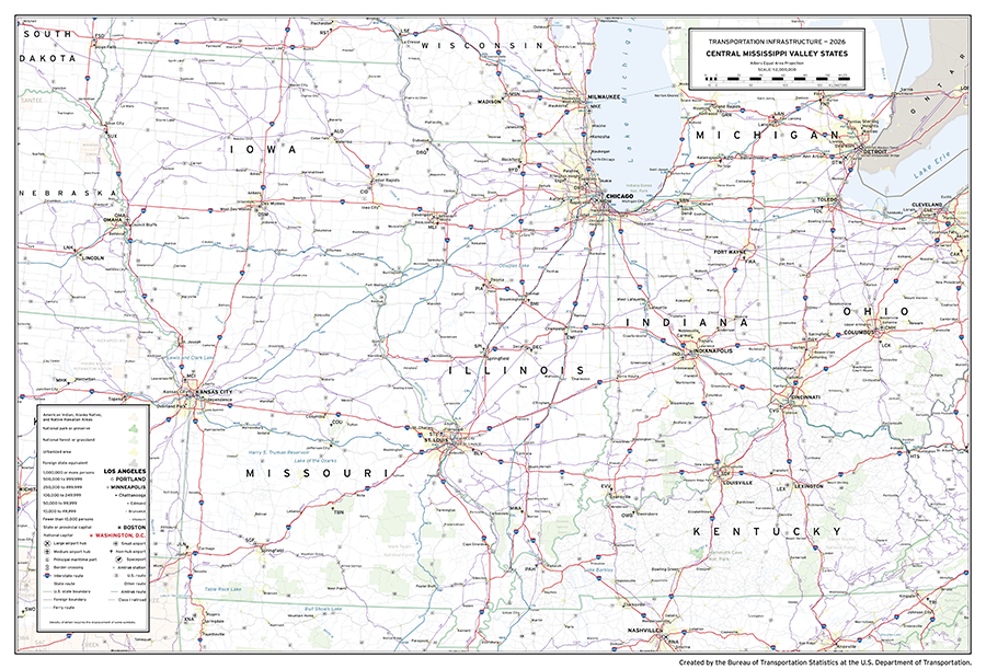
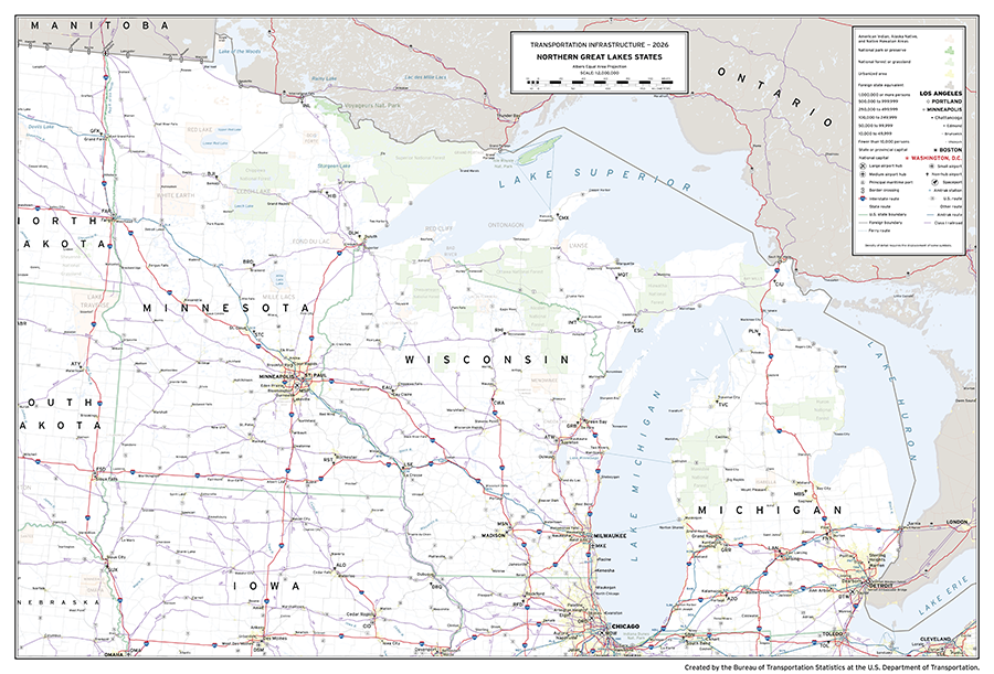
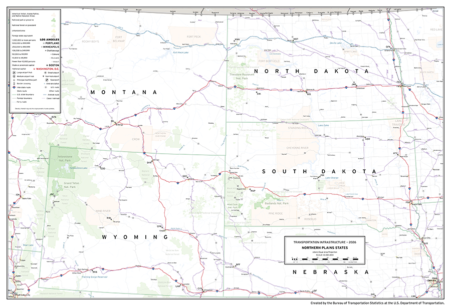
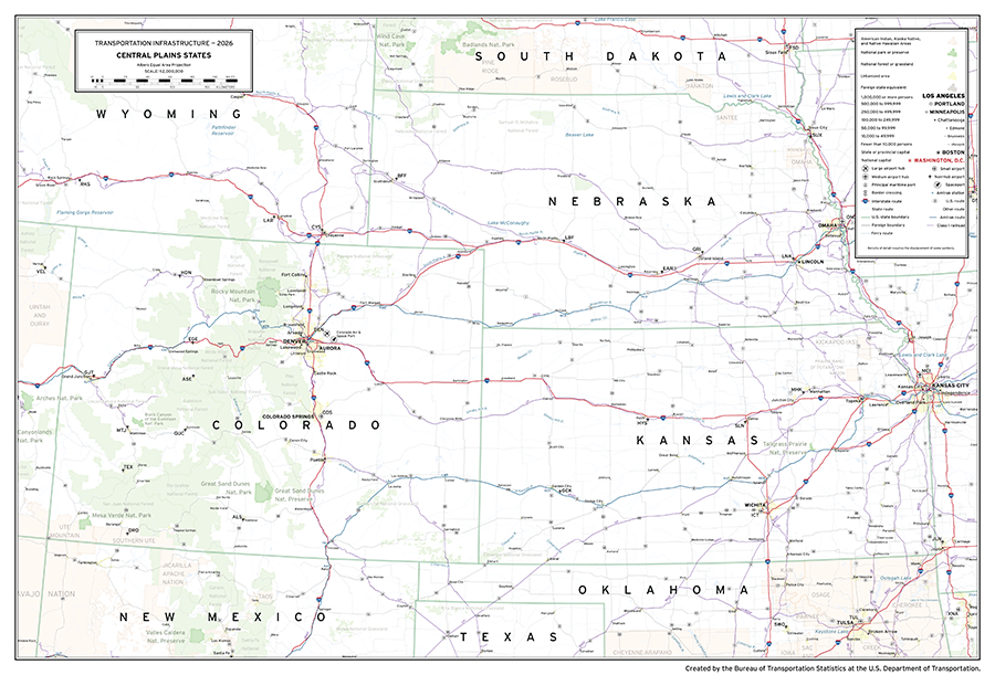
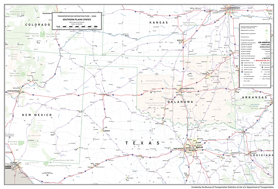
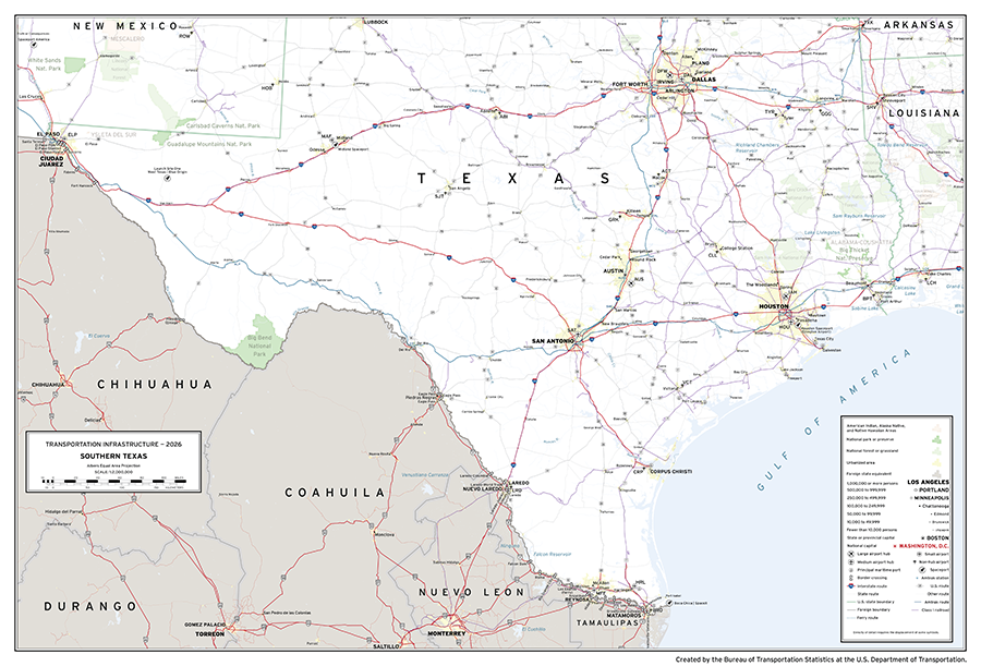
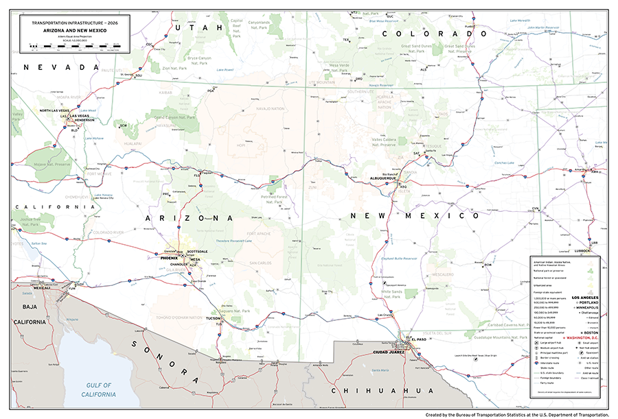
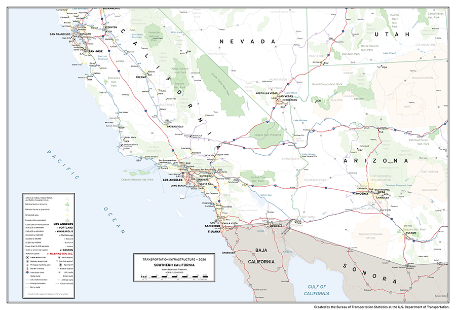
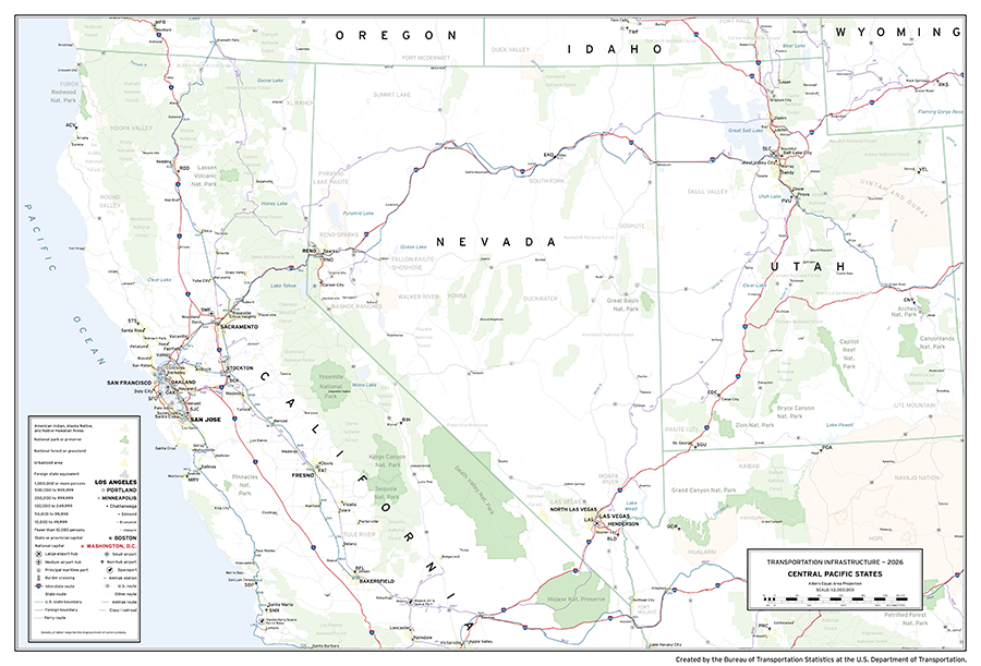
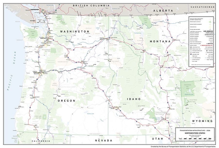
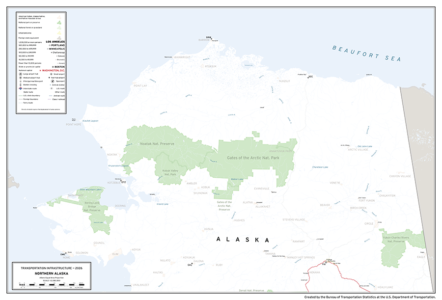
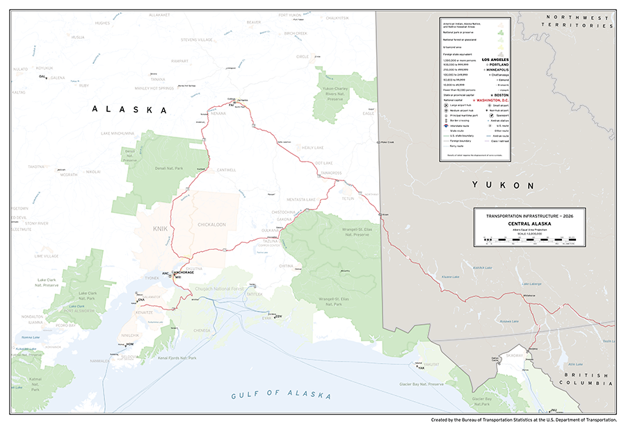
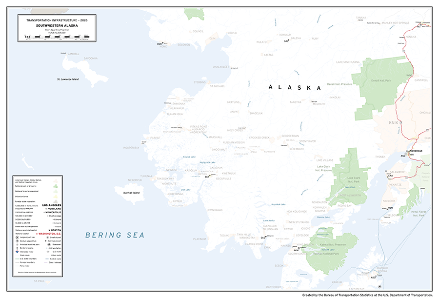
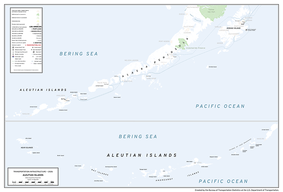
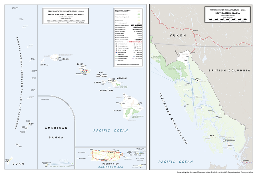
Sectional Area Index
The sectional area index consists of twenty maps at 1:2 million scale comprising the United States of America and its populated territories, which can be found below. These maps feature publicly available data from the Bureau of Transportation Statistics’ National Transportation Atlas Database, the U.S. National Park Service, the U.S. Census Bureau, Federal Railroad Administration, Federal Aviation Administration, and the U.S. Geological Survey. The maps depict transportation infrastructure including airports, spaceports, interstates, U.S. highways, border crossings, Amtrak routes, Class I railroads, and ferry routes.