
National Transportation Atlas Database Spring 2019 Update
Friday, April 19, 2019 - The National Transportation Atlas Database (NTAD) Spring 2019 update was released today with two new datasets, five revised datasets, and a new data catalog.
NTAD is a Bureau of Transportation Statistics (BTS) compilation of geospatial datasets representing the nation’s transportation infrastructure, containing roadways, railways, waterways, and airports.
The two new datasets in this version are the U.S. Department of Transportation regions and air to truck intermodal freight facilities. The air to truck facilities layer is the second in a series of datasets to be released as part of the Intermodal Freight Facility database.
Additional updates in this release include:
- Congressional District attributes provided by the Library of Congress;
- Alternative Fueling Stations from the Department of Energy;
- Rail data including the North American Rail Network (NARN);
- Park boundaries from the National Park Service;
- Travel Monitoring Analysis System (TMAS) information from 2018.
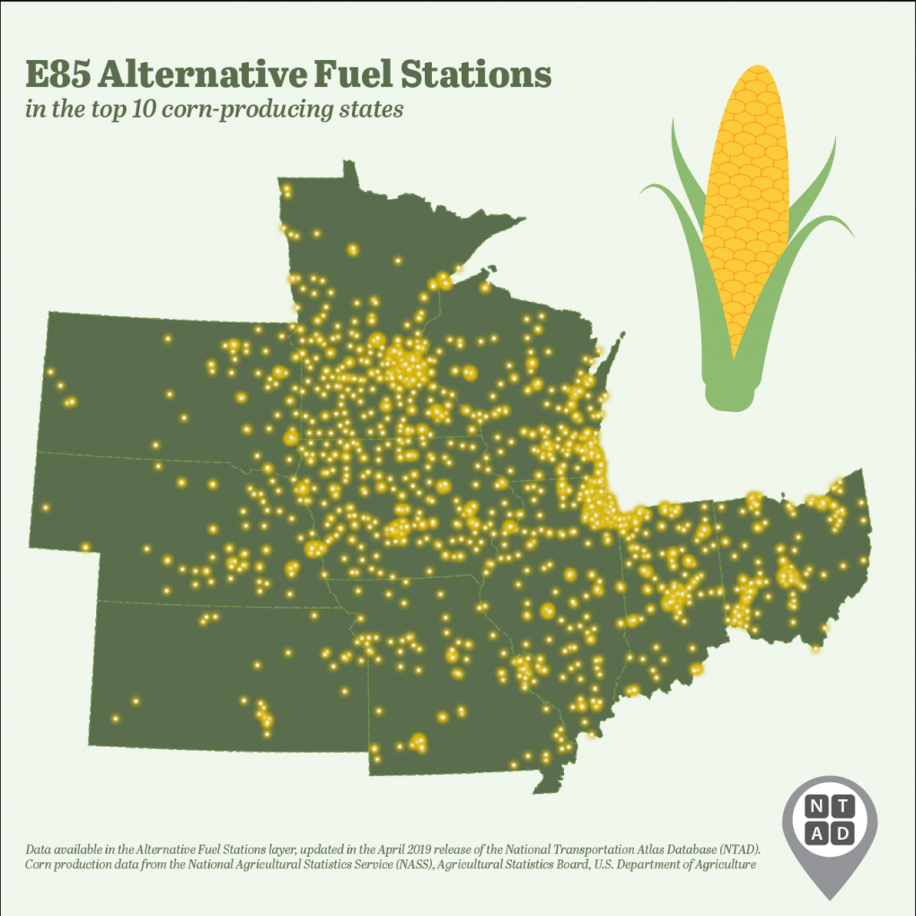
An analysis of the Alternative Fueling Stations data reveals a 4.2% increase in stations between the 2018 and 2019 NTAD versions of these data. Electric charging stations are the most common type in 2019 (24,173; 71.4%), followed by Ethanol 85 stations (3,749; 11.1%) and liquefied petroleum gas (3,334; 9.9%). California has the most stations across all types (6,718; 19.9%), followed by Texas (2,088; 6.2%) and Florida (1,665; 4.9%).
A new and updated open data catalog for NTAD has also been deployed for public use. The new catalog has been streamlined for easier navigation, allowing for faster and more efficient searches.
NTAD is available for download in comma separated values (CSV), Keyhole Markup Language (KML), and shapefile formats through the BTS Geospatial Data Catalog. Additionally, Open Geospatial Consortium (OGC) standard Web Feature Services (WFS) (including Web Mapping Services (WMS)) are available for all NTAD datasets.
BTS now uses a dynamic NTAD publication cycle, making updated data available throughout the year when they become available from their respective government agencies. Follow @TransportStats on Twitter for announcements of additional dataset releases throughout the year. Contacts: Press: Dave Smallen: (202) 366-5568. For technical information and questions: Dominic Menegus: (202) 366-8717.