
Intercity Bus Atlas

The Intercity Bus Atlas (ICBA) is a program to build, publish, and regularly update an interactive, digital mapping application of all scheduled, intercity passenger bus services, as represented by their networks of stops and routes, in the United States.
Intercity Bus Atlas data are sourced directly from North American scheduled bus service providers, who transmit their schedule and network data to BTS using the General Transit Feed Specification (GTFS), a data format initially developed for public transit agencies that makes it easy for any operator of scheduled passenger services to share key information about their networks (e.g., stops, routes, trips, schedules, calendars, fares, and transfers) to the public.
The bus carriers represented on the Atlas either (1) allow BTS to use their GTFS data by agreeing to the terms of the ICBA data-use agreement or (2) maintain a publicly-licensed GTFS feed.
BTS updates the Atlas once a quarter, downloading participating carriers' feeds and compiling their schedule and network data into a single, national-level geodatabase of all scheduled intercity bus stops and routes. Once this file is constructed, its contents are made available for download from the National Transportation Atlas Database and visualized as the stops and routes on the ICBA web map.
Ultimately, the goals of the BTS ICBA program are to:
- Collect geospatial and statistical information about intercity bus travel like that available for other modes of intercity scheduled passenger travel (e.g., commercial airlines, long-distance rail)
- Provide policy-makers and elected officials with data, statistics, maps, and tools to make evidence-based decisions
- Facilitate public- and private-sector research on intercity bus services
- Identify and inventory intercity bus facilities, especially when they facilitate intermodal connections
- Quantify and qualify the density, frequency, extent, and availability of the intercity bus network
Initially launched in 2017 with data from fewer than twenty entities, the ICBA now features the stops and routes of over 40 scheduled intercity bus carriers.
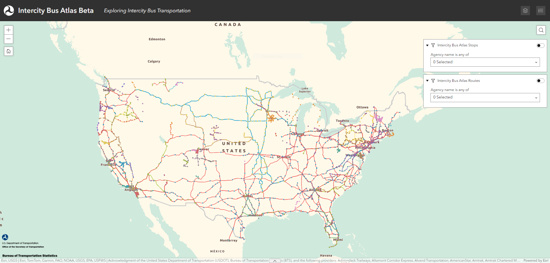
Web map
Click on the screenshot image of the ICBA mapping application to view the interactive tool:
Data downloads
BTS offers the stop and route data shown on the Intercity Bus Atlas map as downloadable GIS layers and as map services (for consumption via web-based mapping applications) through the National Transportation Atlas Database (NTAD).
Use the following links to view and download the most recent versions (June 2026) of these datasets:
| Map layer | Description | Source(s) | Attributes |
|---|---|---|---|
| Stops | All stops served by a participating ICBA Provider, represented as GIS point features. | Based on the "stops.txt" GTFS files submitted by each ICBA Provider. Stop locations are based on the provided latitude and longitude coordinates. |
|
| Routes | All routes served by a participating ICBA Provider, represented as GIS line features. | Based on the "routes.txt" and "shapes.txt" GTFS files submitted by each ICBA Provider. Route locations are based on the sequential latitude and longitude coordinates provided for each route segment. |
|
Notes
- If the GTFS files submitted by a Provider lack a valid "shapes.txt" file, that Provider's routes are depicted as straight-line segments and contain a value of "No" in the column "route_shapes".
- Attributes marked with an asterisk(*) are optional fields within the GTFS and therefore only available if included by an ICBA Provider. These columns have been left blank where not provided.
- Attributes in italics were appended by BTS and were not included in the GTFS files submitted by the ICBA Providers. These locational attributes were spatially joined from the most recent available vintage of TIGER geographies from the US Census Bureau.
- The "schedule start date" and "schedule end date" columns indicate the calendar dates (inclusive) that each stop or route was included in the GTFS schedule data provided by the corresponding ICBA Provider. Outside of these dates, these stops and routes should not be presumed valid or active.
Registration
To add your Provider added to the Intercity Bus Atlas, please visit the Web Registration Form.
If you are unsure that your Provider has already signed the agreement, please send an e-mail to icba@dot.gov.
Memorandum of Understanding
Operators of scheduled intercity bus services ("Carriers") can sign a Memorandum of Understanding (MOU) before providing their schedule and network data to the Intercity Bus Atlas, an agreement that leverages BTS' significant experience with confidential data.
The terms of the MOU are intended to:
- Protect any sensitive business information contained in Carriers' shared data files
- Discourage improper uses of the data, i.e., real-time or near-real-time trip planning, scheduling, or navigation
- Prevent the data from being shared improperly or sold commercially
- Ensure Carriers are appropriately cited for their data
- Promote the use of ICBA data for research, analysis, and planning
BTS will not add a Carrier's data to the Atlas without their consent. The only exceptions are Carriers that operate scheduled intercity services and who make their GTFS feed openly-available with a public-domain license. Most often, these are public transit operators whose data and services are also captured by the National Transit Map and the National Transit Database.
Once a Carrier signs the MOU, BTS agrees to collect, compile, publish, and archive their schedule and network data at least once, and not to exceed four times, a year. As part of this process, BTS publishes all subsequent ICBA products (e.g., maps, GIS layers) to the National Transportation Atlas Database where the data are available through a Creative Commons Attribution – Non-commercial 4.0 International (CC-BY-NC 4.0) license.
BTS can remove a Carriers' data from the Atlas at any time, once it receives a written request from a representative of that operator at icba@dot.gov.
By volunteering to provide their data, participating Intercity Bus Atlas carriers support its fundamental goal to document, map, and study the extent of the intercity bus industry vis-à-vis the national transportation system of the United States.
The ICBA currently features the stops and routes of over 40 participants:
- All Aboard America
- Amtrak Connecting Service
- Alvand Transportation
- Amtrak Chartered Vehicle
- Arrow Trailways
- Beeline Express
- Executive Transportation
- Roadrunner Shuttle
- Route 66 Express
- Stagecoach Express
- Sunway Charters
- The Lift
- Vegas Airporter
- Barons Bus
- Bay Runner Shuttle
- Beeline Express
- Birnie Bus Service
- Bustang
- C&J Motorcoach
- Central Oregon Breeze
- Coach USA
- Community Coach
- Newark Airport Express
- Orange Westchester Link
- Rockland Coaches
- ShortLine Hudson
- Suburban Transit
- Van Galder (Coach USA)
- Wisconsin Coach Lines
- Delta Bus Lines
- Express Arrow
- Flix Bus
- Greyhound
- Froggy Transportation
- Fullington Tours
- Go Bus
- Indian Trails
- Jefferson Lines
- Land to Air Express
- Miller Transportation Company
- Monsey Trails
- Northwestern Stage Lines
- Oregon POINT
- OurBus
- Pacific Crest Bus Lines
- Peter Pan Bus Lines
- Peter Pan Bonanza
- Salt Lake Express
- Sunway Charters
- Trailways
- Travel Washington
- Vermont Translines
- Virginia Breeze
* This list is based on the "agency_name" values contained in the "agency.txt" file within the GTFS file package submitted on behalf of each ICBA Provider. A carrier may operate some of its routes on behalf of other Providers and it may appear on the list in more than one capacity (i.e., as an independent Provider and/or as a contract or interline Provider on behalf of another).
Overall ICBA program
- Is participation in the Intercity Bus Atlas mandatory? Carriers are not required to participate in the Intercity Bus Atlas. A Carrier's network will not be added to the Atlas if they have not consented to the ICBA MOU. The only exceptions are Carriers who operate scheduled intercity bus services and maintain a freely-available GTFS feed of their schedule with a public domain license.
- In what format do Carriers provide their network data to BTS? Carriers are encouraged to provide their schedule and network data to BTS using the General Transit Feed Specification (GTFS). Originally developed to make it easier for transit providers to more easily share information to the public on their agency, routes, trips, stops, fares, and transfers, GTFS is the preferred data format for the ICBA because its file structure makes it easy to quickly map an operator's network of stops and routes. Additionally, BTS expects many Carriers to already maintain a version of their schedule using GTFS because it is required for their services to appear on popular web trip planning applications.
- Can I get access to Carriers' GTFS feeds and files? Under the terms of the MOU, BTS cannot give the GTFS feeds and files submitted by Carriers directly to the public, a decision made primarily to avoid their use for real-time trip planning. However, if a Carrier maintains a GTFS feed with a public domain license, a user may be able to find that data directly from the Carrier or through the resources provided by the National Transit Map program.
- What changes to the Intercity Bus Atlas can I expect in the future? BTS is building a protocol to robustly identify, add, and update missing or out-of-date networks on the Atlas, ensuring it represents all active, eligible scheduled intercity bus Carriers currently operating in the United States. BTS are also exploring the addition of route and schedule frequency to the Atlas and the removal of the non-intercity components of the public transit networks currently included on the map.
Carrier-specific
- How do I confirm my Carrier has signed the ICBA MOU? Please send an email to the ICBA inbox and a BTS representative will get back to you as soon as possible. Please include any relevant information about your registration status, especially the date or year you believe you first signed the agreement.
- I am a Carrier whose GTFS feed is maintained by a third-party entity. What do I do? BTS recently added an option to the ICBA Web Registration Form for Carriers to provide the contact information of the third-party company or entity responsible for maintaining your GTFS feed. If you have any questions about completing these items on the form, please send an e-mail to the ICBA inbox.