


Intercity Bus Atlas Departs the Station
The Bureau of Transportation Statistics (BTS) announces the relaunch of the Intercity Bus Atlas, an interactive, digital mapping application of scheduled, intercity passenger bus services in the United States.

The Atlas now features the newest stop and route information from a group of nearly 60 scheduled intercity bus providers, all of whom volunteered their schedule and network data to BTS for this project. The updated map features approximately 3,500 stops from 1,800 routes, representing scheduled services across the entire United States.
This update underscores BTS as the federal home of the only regularly-updated, comprehensive, public map of the scheduled intercity bus network of the United States. This revitalized tool provides researchers, policymakers, and planners with national-level data on the availability and connectivity of a mode of long-distance passenger transportation missing from previous statistical and cartographic products.
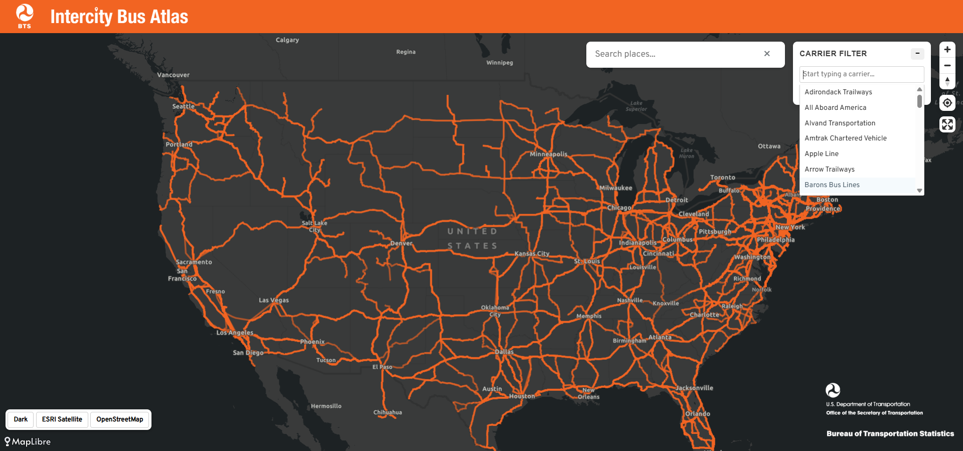
Users are welcome to download the geospatial files representing the stops and routes of the national network from the National Transportation Atlas Database.
BTS will update the Intercity Bus Atlas on a quarterly basis, using the newest schedule and network data from participating carriers. Future versions of the ICBA will include additional carriers as well as more information on route and stop frequency.
For more information, or to ask questions about the ICBA, contact icba@dot.gov.